Following the severe damage to farmland in the Yalu River basin caused by heavy rains in late July, recent satellite images have revealed significant destruction to farms in the northern part of North Pyongan province.
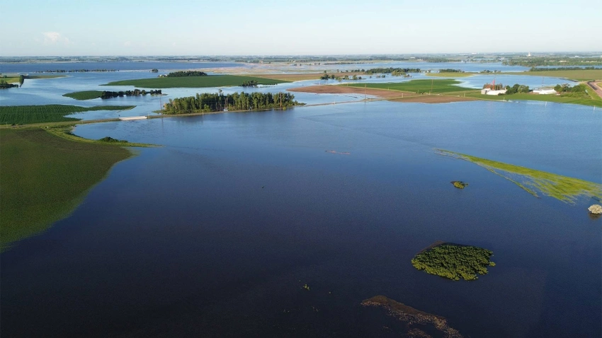
According to satellite images taken on Aug. 15 by Sentinel-2A, a satellite operated by the European Space Agency (ESA), farming areas along the Yalu River and in the interior of North Pyongan province were inundated by muddy water, with crops being swept away by the flood. The satellite images showed that several farming areas had suffered damage, including a wide layer of yellowish mud covering flooded areas.
My analysis of the satellite images found that crops had been damaged or lost in sections of Sinuiju measuring 2,960 hectares, or about half the area of Manhattan (5,910 hectares) — and that only includes the areas visible between cloud cover.
Many rice paddies were swept away in the flooding, compromising this year’s rice harvest. This means that farmers in the area, already facing significant challenges, will have to pivot to non-paddy crops in the year’s second half. After the flood damage has been dealt with and the fields readied for sowing, farmers will get off to a late start and have to work hard to plant a new batch of corn.
In addition to the direct crop loss, the muddy floodwaters have weakened the remaining crops, making them more susceptible to insect infestations and plant diseases. This, coupled with the late start due to the flood damage, means that farmers in the area are unlikely to meet their targets for the fall harvest.

Weather conditions in Sinuiju and other parts of North Pyongan province have been poor since mid-July. Because of heavy cloud cover, few photographs have permitted a decent view of conditions on the ground. It was not until Aug. 15, more than two weeks after the flooding, that satellite images of the sun shining between the clouds were available, enabling me to examine the damage caused by the heavy rains.
After examining several areas through breaks in the clouds, flood damage was detected across a wide swath of the Yalu River basin near Sinuiju on Aug. 15 compared to satellite photos taken on July 18, before the heavy rains. Farmland was damaged throughout the river valley, including Wihwa Island, and there were several areas where crops had been lost, and fields were covered with mud. Even when only the areas visible through the cloud cover were analyzed, the damaged areas (including where crops were washed away) measured around 1,820 hectares.
The damage appeared to be particularly severe around Uiju Airfield and in areas visited by Kim Jong Un on his train on July 28.

Farmland in the Yalu River basin was damaged in Sujin and Taehwa villages in Uiju county, North Pyongan province. Crops were also washed away, revealing bare dirt on long stretches of the river in several places.
After the torrential downpour, North Korean and Chinese farms in the Yalu River basin were submerged under muddy waters. Crop loss was one of the flooding’s negative impacts. Crop loss was observed in 320 hectares in Uiju county, North Pyongan province, and 330 hectares in Chinese territory.

In Yongchon township and Sandu village in Yongchon county, North Pyongan province, the Samgyo Stream overflowed its banks amid the heavy rain, sweeping away the crops in the fields and turning the once-green river basin into a muddy brown. The imagery showed that lowlands had been inundated as far as 2.2 kilometers inland from the stream. My analysis found that 670 hectares of farmland around the Samgyo Stream had suffered crop loss and other damage because of the flooding.

A long section of the river valley near Samgyo Stream in Ronggye village, Pihyon county, North Pyongan province, was submerged by flood waters that washed away crops, uncovering the bare dirt below. The crop loss and other damage to farmland along the Samgyo Stream covered 150 hectares.
Causes of the flood damage and prospects for the fall harvest
North Korea has suffered both material and human loss in the monsoon season each summer and the typhoons that pass over the Korean Peninsula each fall. Again and again, villages are submerged in water, roads become impassable, and farmland is inundated.
One cause of these devastating floods is undoubtedly localized downpours caused by extreme weather, but the July monsoon passed over South Korea before reaching North Korea. South Korea also suffered damage from the torrential rain, but not as severely as North Korea.
Many North Korean hills are bare of trees, significantly degrading forests’ ability to retain water and mitigate flooding. Moreover, there are inadequate irrigation canals and other flood mitigation facilities.
In the areas near Sinuiju, in the Yalu River valley, torrential rains flooded farmland, washing away crops and leaving behind a layer of mud. Restoring the farms to working order will be challenging.
In the paddies, rice seedlings have been washed away, ruining this year’s rice crop. Even in the fields, undoing the flood damage will take time, pushing back the planting of corn, potatoes, and soybeans to later than ideal.
Waterlogged and mud-covered crops are weakened, rendering them vulnerable to pests and blight and likely lowering their yearly output. This suggests that the fall harvest in the northern section of North Pyongan province, near Sinuiju, will fall short of this year’s agricultural goals.
Source - https://www.dailynk.com