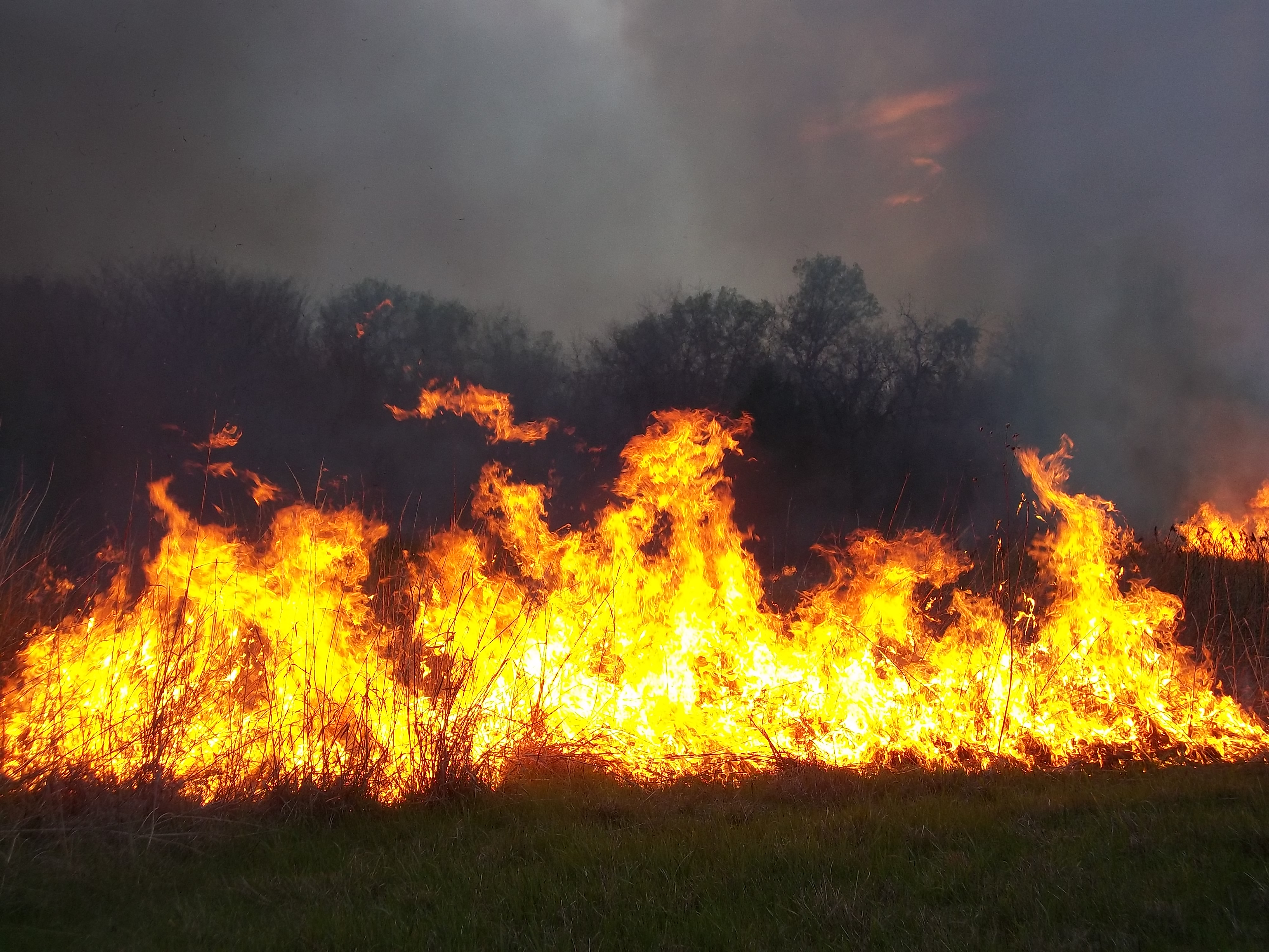
Thick rain clouds descended on Kansas City on Monday, but they will offer only limited relief to the months-long drought conditions affecting the area. Among other impacts, the dry, hot and windy weather contributed to grass fires over the weekend in south Kansas City between Raytown and Lee’s Summit.
An unusually dry spring and summer have left the metro parched, National Weather Service meteorologist Jared Leighton told The Star.
Kansas City typically sees around 39 inches of rain in a given calendar year. This year, we’re at just 28 inches so far — well below the approximately 35 inches meteorologists would expect to see by this date.
HOW BAD IS THIS YEAR’S DROUGHT?
This year’s drought started in early July and has only gotten more severe in the subsequent months, Leighton said.
The University of Nebraska’s drought monitor has classified the Kansas City area as having “extreme drought” conditions since the beginning of October. That’s the second-highest level of drought intensity measured by researchers.
Much of southern Kansas is seeing “exceptional drought,” the highest level possible.
“Droughts are slow to build and slow to go away,” Leighton said. “We may not be out until spring or next summer, because that’s when the moisture typically comes in.”
Fall and winter are usually the dryer seasons in the Kansas City area, so we’re unlikely to see significant rainfall in the last few months of the year making up for the deficit we acquired this summer.
Leighton said it’s impossible to predict exactly how much precipitation is on the way in the coming months. But if dry conditions last until spring, it would make this year’s drought longer than the 2012 dry spell that led to significant crop loss and other challenges 10 years ago.
WHAT DOES RAIN MEAN FOR THE DROUGHT AND FIRES? Leighton noted that Monday’s rain doesn’t mean that the drought is over — but it may provide temporary relief from the dry conditions that have caused fires in the area to spread more easily, reducing the risk of fires for this week at least.
“We’ve already seen a lot of grass fires in the area,” he said. “It can be very easy to start a grass fire when things are really [dry] like they are now.”
You can check on the status of fires in the area using the NOAA’s fire map. Current forecasts show the chances of fire are low in the coming days. Polk County has a burn ban in place as of Monday, but no other Kansas City area counties have enacted those measures.
The University of Missouri Exntension advises people to be more cautious of open burning during drought conditions and to check with your fire department to see if there is a burn ban in place before burning, because droughts increase the risk of fire spreading and being difficult to contain.
Here are tips from the Missouri Department of Conservation to prevent fires while the Kansas City area is experiencing drought conditions.
Before starting an outdoor burn:
- Check the weather. Take more caution and consider not starting a burn if humidity is low and the weather is windy.
- Check for burn bans.
Before starting a campfire or bonfire:
- Make sure you have a clear area around the fire. If the fire blows in the wind, stray sparks or embers can start fires in nearby debris.
- Don’t use gasoline, kerosene or other flammable liquids to start a fire.
- Keep extra firewood away from the fire.
- Have something nearby that you can put the fire out with.
- Never leave a fire unattended.
Source - https://www.kansascity.com
Read more at: https://www.kansascity.com/news/weather-news/article267801727.html#storylink=cpy