

UK - Rezatec new mobile app helps farmers increase crop yields by 12%
12.02.2020 730 views
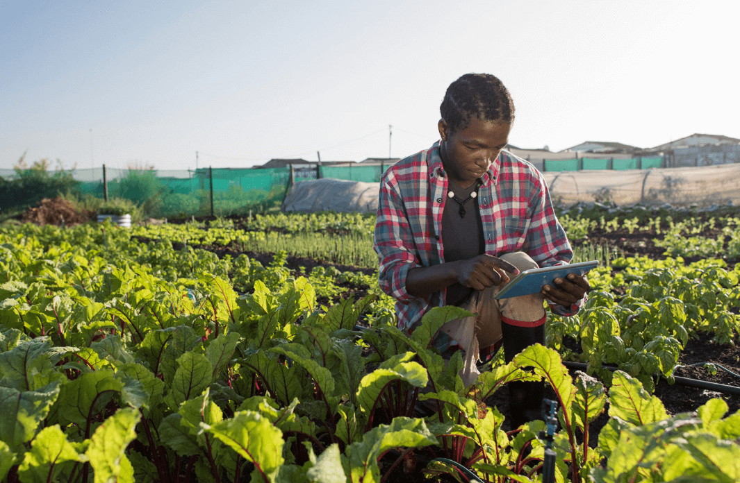
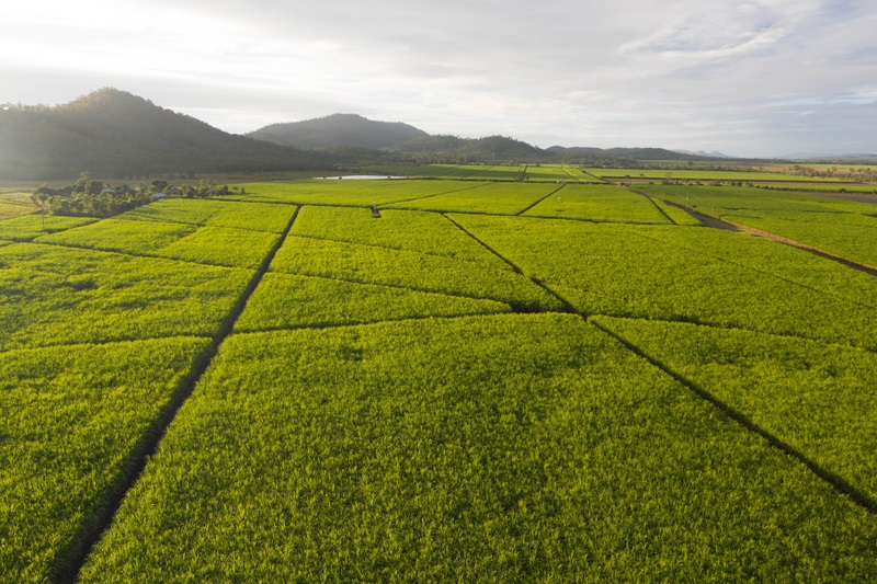
Rezatec, a leading provider of geospatial data analytics, has launched a free smartphone app that acts as a portal for farmers to record their agricultural activities and provides recommendations for optimal sowing and irrigation scheduling. Based on preliminary results from the experimental stations, the app has demonstrated the potential to increase wheat yields by up to 12%.
COMPASS v2.0 provides decisions based on Earth observation satellite data, in-situ field data captured by farmers, and a sophisticated crop model, to identify factors that might cause lower crop performance. In the Yaqui Valley in Mexico, a region that relies on irrigation due to varying climatic conditions, water security is a serious challenge. With general circulation models predicting less water availability in the future, farmers must be very precise in their irrigation management. The technology will track crop growth performance allowing farmers to make more informed decisions about crop management.
“Yaqui Valley farmers are very experienced farmers; however, they can also benefit by using an app that is designed locally to inform and record their decisions,” explains Francelino Rodrigues, Precision Agriculture Scientist at CIMMYT. “Sowing and irrigation timing are well-known drivers of yield potential in that region – these are two features of the app we’re about to validate during this next season.”
The COMPASS project, led by Rezatec and part-funded by the UK Space Agency’s International Partnership Programme, is a collaboration between international scientists, businesses, farmers and agriculturalists, aimed at finding ways to use satellite data to better manage factors that cause the yield gap between crop potential and actual field performance in South America. Rezatec provides geospatial data analysis and the underlying technical platform upon which the project is based.
In October 2019, the UK Space Agency awarded additional funding to increase the scope of the project to include the crop maize, and to expand into Argentina.
“Extending the project to Argentina enables us to provide our innovative satellite-derived tools to even more farmers to enable them to make really critical decisions based on new insights about their crops and land that they previously didn’t have access to”, explained Dr. Andrew Carrel, Chief Technology Officer at Rezatec.
Source - https://www.geospatialworld.net
EVENTS

ScaleAgData Stakeholder Engagement Event
22.10.2024The ScaleAgData project is pleased to invite you to our second stakeholder event. Building on the discussions and connections formed during our first webinar, this event will focus on fostering collaboration among stakeholders, providing updates on our project’s progress, and outlining future opportunities for engagement.
RISK EVENTS

Moldova - May frosts caused heavy damage to fruit orchards
10.05.2026The first frosty nights of May have significantly worsened estimates of damage to Moldova's fruit sector from spring frosts. According to initial assessments by fruit market operators, between a quarter and a third of the country's total orchard area was seriously affected.
02.08.2026

USA - Lightning caused wildfire burns 100 acres causing thousands of dollars of crop loss
After an intense thunderstorm passed through eastern Idaho Thursday evening, sparking a fast-moving wildfire, fire crews have brought the blaze under control.
02.08.2026
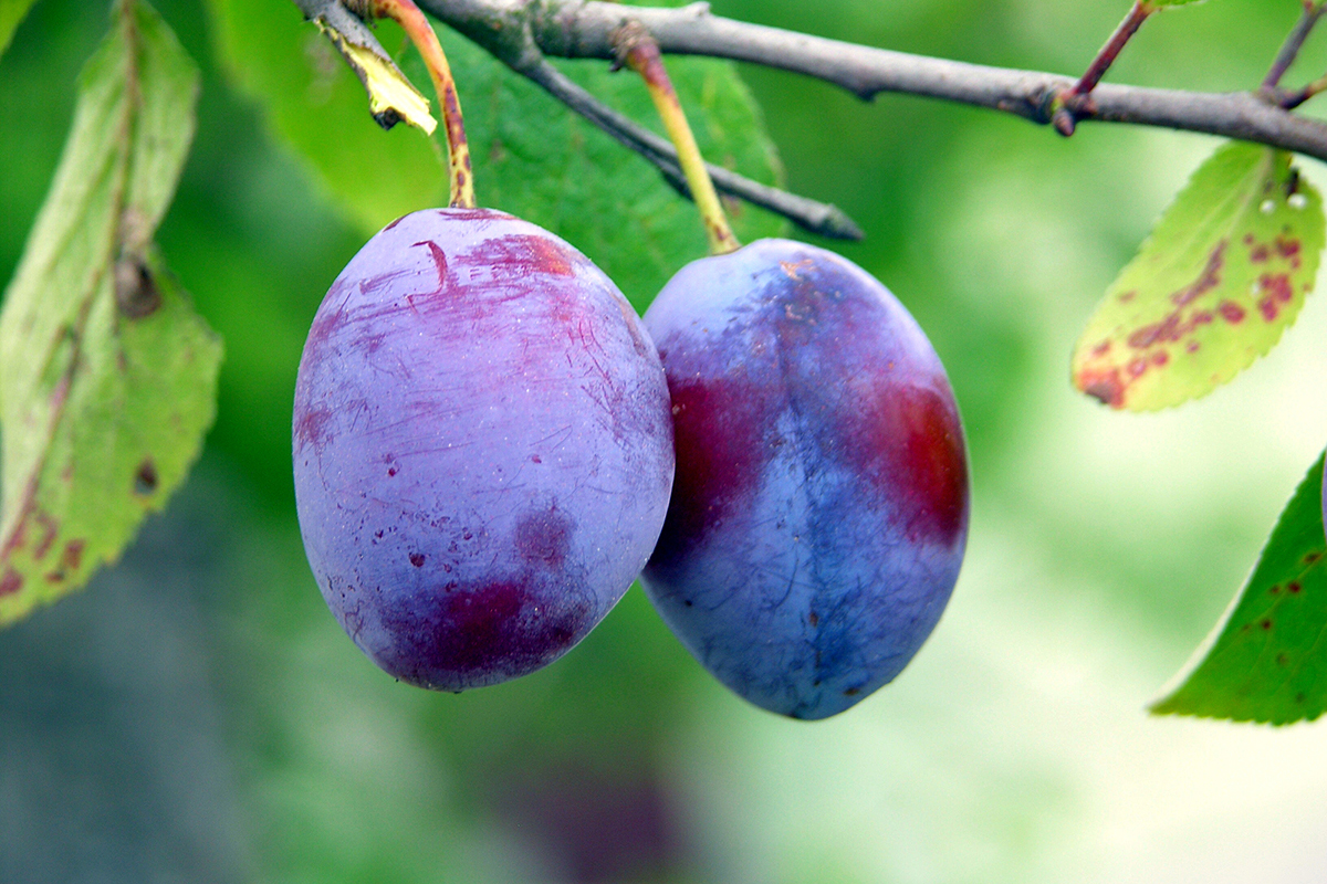
Italy’s plum supply plunges after hail and heat wipe out up to 80% of crops
European plum buyers are facing tighter supplies and significantly higher prices after violent hailstorms, strong winds and extreme heat caused severe crop losses across several key production regions.
02.08.2026
India - Tripura launches first livestock insurance scheme; govt to bear 85% premium, cover up to Rs 50,000
Tripura has introduced its first-ever livestock insurance scheme, under which the government will bear 85 per cent of the premium cost, while livestock farmers will have to pay only the remaining 15 per cent, Animal Resources Development Minister Sudhangshu Das said.
02.08.2026

USA - Cyclospora Outbreak Tanks Lettuce Demand and Forces Crop Destruction
A nationwide cyclospora outbreak has severely reduced American consumer demand for fresh greens, forcing some major agricultural producers to destroy healthy crops while driving a surge in business for small local farms as thousands fall ill across the country.
02.08.2026
Hanover losses spotlighted in Lloyd’s study on Caribbean insurance gaps
A study commissioned by Lloyd’s, the London-based insurance and reinsurance marketplace, found that farmers, fishers and tourism workers in three hurricane-exposed Caribbean countries — Jamaica, Barbados and Grenada — are left to replace lost boats, crops, livestock and equipment themselves because they lack insurance.
02.08.2026

French wine industry could face struggle after fire damage ruins crops
Wildfires in France have caused damage to homes, businesses and forests, and now they threaten to damage the French wine industry.
30.07.2026

Half of England declared in drought as insurers face exposure beyond subsidence
Record payouts, repeat drought conditions and ageing housing stock are reshaping how property insurers approach renewal risk.
30.07.2026
India - Poor rainfall, white grub infestation threaten sugarcane crop across Dharmapuri
Farmers fear heavy crop losses as drought and white grub attacks dry up and rot sugarcane fields, prompting demands for pest-resistant, drought-tolerant varieties.
