Heavy rains triggered by Wutip, the first storm to enter Vietnamese waters this year, have caused landslides, severe flooding, and extensive crop damage across central regions including Quang Tri, Hue, Da Nang, and Quang Nam.
Storm Wutip has triggered intense rainfall across central Vietnam over the past two days although it was still more than 300 km from the Vietnamese mainland, near the Hoang Sa (Paracel) Islands.
Meteorological data shows that between 7 p.m. Tuesday and 4 p.m. Wednesday, rainfall dumped on Quang Binh, Quang Ngai and Kon Tum provinces ranged from 200 to 300 mm, with certain areas recording between 350 and 550 mm.
Heavy rains combined with steep mountainous terrain caused flooding at low-level bridges and spillways in Dakrong District, Quang Tri Province. Border guards have established checkpoints on National Highway 15D, where water levels rose between 0.5 and 1 meter, prohibiting all vehicle and pedestrian crossings.
Rising water levels in the Se Pon River have submerged two flood-prone areas.
In this photo, border guards from Huong Hoa District in Quang Tri Province work with local residents to set up barriers and warning signs.

In Phu Loc District of Hue, a landslide damaged a 20-meter section of road leading to the La Son–Tuy Loan Expressway. Authorities have set up warning signs and closed the area to vehicles.
In Da Nang, after two days of heavy rainfall, massive boulders rolled down the mountainside onto Hoang Sa Road on the Son Tra Peninsula on Thursday morning.
Workers clear the debris to ensure safe access to nearby resorts.
In Quang Nam, flash floods inundated roads in Axan Commune, Tay Giang District, prompting authorities to set up rope barriers to restrict access for local residents.
In Dai Loc District, rising waters from the Vu Gia River combined with discharge from the Song Kon hydropower plant caused flooding in Dai Hung Commune early Thursday. Over 300 homes were submerged in nearly one meter of water, and almost 100 hectares of crops, including sesame and mung beans, were destroyed. Rice fields planted just 15 days earlier are also at high risk of total loss.
"This is the first time I've seen flooding in the middle of summer," said Nguyen Quoc Than, 42, chairman of Dai Hung Commune.
Flood-affected locals rushed to harvest vegetables from riverside fields, hoping to salvage some produce for sale, though much of the farmland was already submerged.
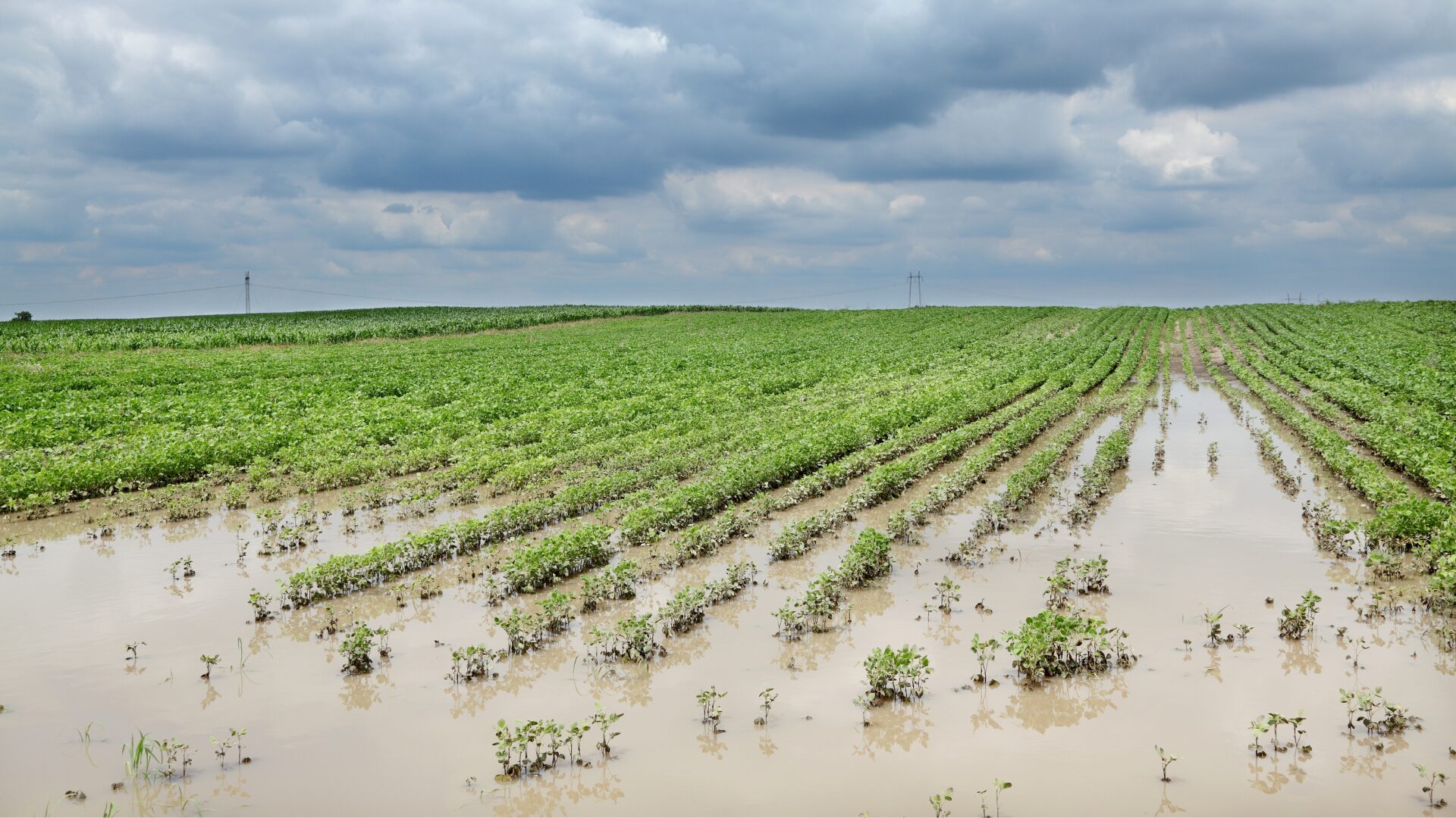
Large areas of crops have been submerged across multiple provinces on Thursday.
Overnight floods also submerged watermelon fields along the Quang Hue River in Dai Cuong Commune, Quang Nam Province, just as the harvest season approached. Local residents had to use boats to retrieve floating watermelons and bring them ashore for sale.
Storm Wutip reached its peak intensity on Friday morning. According to Vietnam’s National Center for Hydro-Meteorological Forecasting, as of 4 a.m., winds at the storm's center reached 102 kph in the southern waters off China's Hainan Island. The storm was moving northwest at 10 kph and is forecast to enter the Gulf of Tonkin, bringing more heavy rain to northern and central Vietnam and causing rising sea levels from Hai Phong to Nghe An.
By 4 a.m. tomorrow, as Wutip reaches the northeastern waters of the Gulf of Tonkin, it is expected to shift direction from north-northwest to north-northeast while maintaining its intensity. The following day, the storm is anticipated to weaken into a tropical depression as it moves into the southwestern part of Guangdong Province in China.
The past and forecasted path of Storm Wutip off Vietnam's central and northern coast. Graphics by Vietnam Disasters Monitoring System
Source - https://e.vnexpress.net/