

How do drones work in agriculture?
22.01.2016 534 views
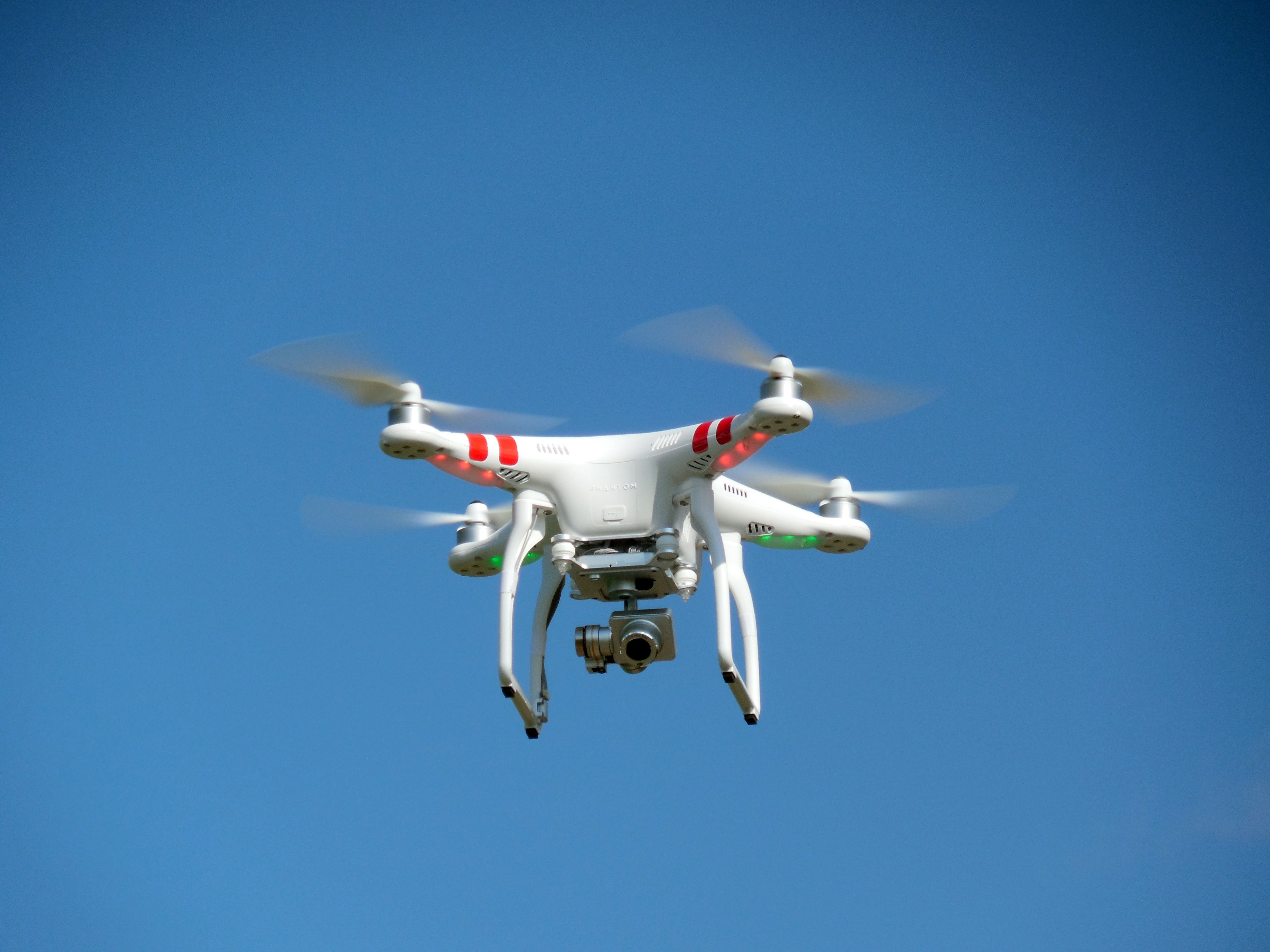
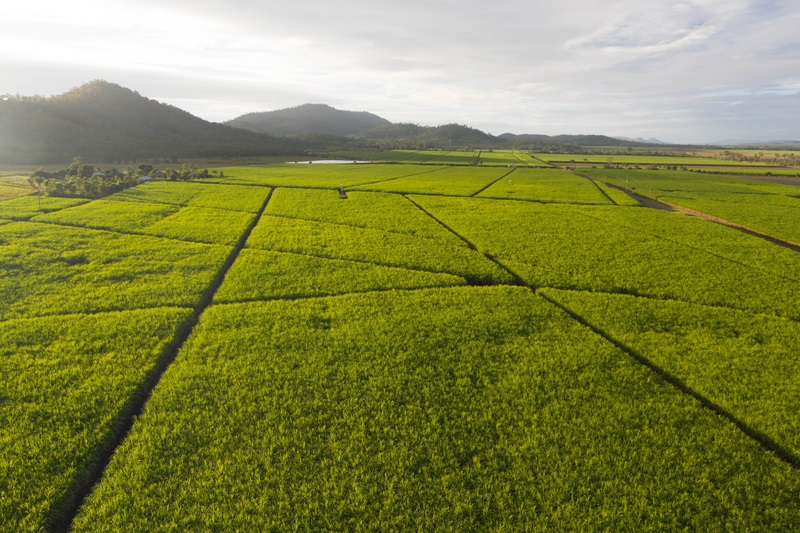
Drone technology has the potential to change the way farmers scout their fields for situations like disease issues and pest pressure. The technology appears to have come a long way in a relatively short time, but there’s a more basic question to ask first: How does it work?
“If you’re a farmer who wants to use a drone, it’s like having a 200-foot ladder to survey your field,” said Ian Smith, business development and marketing manager for Drone Deploy of San Francisco. “Usually a farmer would take some pictures of the field, but just pictures won’t get you a lot of useful information.”
Smith added, “Instead, you need to create maps.”
The Drone Deploy software includes an app for smartphones.
“You can connect your smartphone directly to the drone with the app,” Smith said. “Our software lets you create aerial maps, 3D models, and images of your entire field. The images will be zoomable, high quality and high resolution.”
The smartphone is hooked into the drone control unit through a USB port.
“When you open the app up, it’s connected to the drone,” Smith said. “You then draw on a base layer map and your drone’s GPS location shows up, similar to what you’d see on Google Maps to figure out where you are. Our app allows you to draw boundaries on a map that will show the drone where to go and take pictures.”
Basically, the farmer drags the corners of a box to outline the area to survey, and hits “okay.” A split second later, the software draws up a flight plan.
“The drone runs through a few flight checks, and then it automatically takes off straight up into the air,” Smith said. “It then starts to fly through the designated area and takes pictures. It surveys the field through waypoints on the map, getting good overlap between pictures. It then lands in the exact spot it took off from.”
He said the farmer never has to touch the drone’s joystick. The app pilots the machine automatically.
“When the drone lands,” Smith said, “you pull an SD card out of the drone. It’s similar to a card you’d find in a digital camera. You take it out of the drone and pop it in your computer, where you upload all those images to the Drone Deploy system. The system uses a photogrammetric stitching process to bring all of the pictures together into one high quality image.
“It’s basically like having your own Google map of your farm field,” Smith said.
How high the drone will fly depends upon how much area you need covered in the map.
“There’s a default altitude that we set,” Smith said, “usually 250 feet above ground. Changes depend upon how big your picture needs to be. If you have a 400-acre farm, you’d probably want to fly higher than that because you have more ground to cover.”
Flying higher to cover more ground can actually save on battery life for your drone.
“If you adjust parameters, such as height, with our app, it will update in real time how long that flight is going to take,” Smith said. “If your drone has a battery that lasts 20 minutes, and you adjust it to fly higher, it covers more ground in shorter time. The flight time then will drop in real time, so you make sure you have enough battery for each flight.”
The actual stitching process of your photos is entirely automatic.
“Even when we’re all asleep here in San Francisco (company headquarters) and someone is making a map in Australia,” Smith said, “it’s all automated. No one has to be awake at all.”
Once the images are uploaded, then it’s time for a farmer to wait.
“You go grab a cup of coffee, or whatever,” Smith said. “Depending upon the size and quality of the images you collect, in a couple hours, you’ll get an email saying your map is done. Once you click on the link, you’re right in your high quality, high resolution map that same day you took the pictures.”
He said same-day data is important for farmers, as things can literally change overnight because of events such as severe weather.
Turnaround time on getting the stitching process done rarely takes more than a few hours.
“It all depends on things like how many pixels are in each image,” Smith said. “For example, a high-end camera can take 60-75 seconds per image to process, so if you throw around 50 images in there, you’re probably looking at around an hour turnaround time.”
Even if the system is processing a large number of maps, you’ll still get your map back in a short time.
“With the horsepower we have in our big servers,” Smith said, “even if we’re processing 50 maps, you’ll still get your map back relatively quickly.”
High-end drones can run up to $3,000, he said. You don’t have to spend that much to get a good map, but there is a baseline recommendation.
“The lowest you may want to go if you’re getting into this today is probably $1,000,” Smith said. “However, six to eight months from now, you’ll probably be able to spend $800, and a couple years from now, it’ll be lower than that.”
Источник - midwestproducer.com
EVENTS

ScaleAgData Stakeholder Engagement Event
22.10.2024The ScaleAgData project is pleased to invite you to our second stakeholder event. Building on the discussions and connections formed during our first webinar, this event will focus on fostering collaboration among stakeholders, providing updates on our project’s progress, and outlining future opportunities for engagement.
RISK EVENTS

Moldova - May frosts caused heavy damage to fruit orchards
10.05.2026The first frosty nights of May have significantly worsened estimates of damage to Moldova's fruit sector from spring frosts. According to initial assessments by fruit market operators, between a quarter and a third of the country's total orchard area was seriously affected.
02.08.2026

USA - Lightning caused wildfire burns 100 acres causing thousands of dollars of crop loss
After an intense thunderstorm passed through eastern Idaho Thursday evening, sparking a fast-moving wildfire, fire crews have brought the blaze under control.
02.08.2026
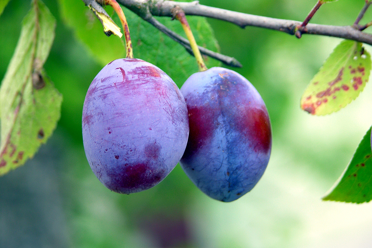
Italy’s plum supply plunges after hail and heat wipe out up to 80% of crops
European plum buyers are facing tighter supplies and significantly higher prices after violent hailstorms, strong winds and extreme heat caused severe crop losses across several key production regions.
02.08.2026
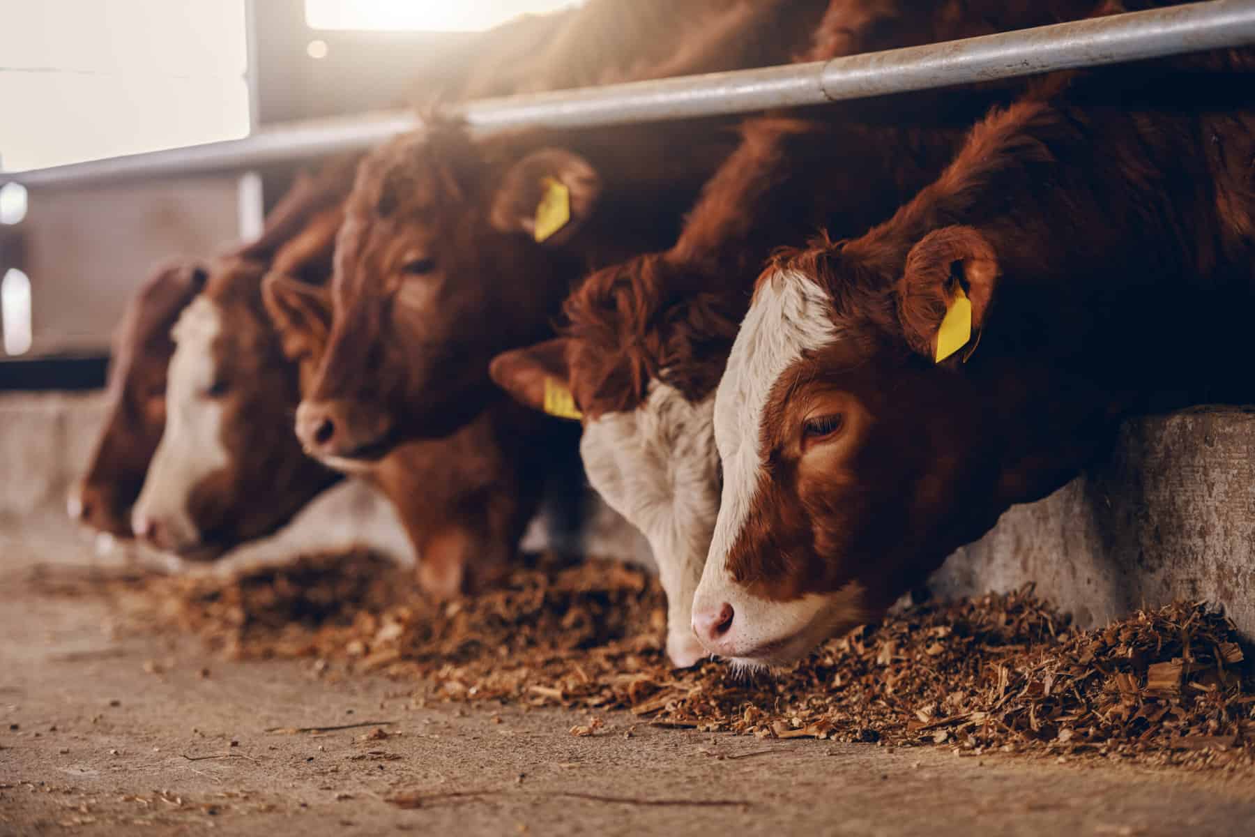
India - Tripura launches first livestock insurance scheme; govt to bear 85% premium, cover up to Rs 50,000
Tripura has introduced its first-ever livestock insurance scheme, under which the government will bear 85 per cent of the premium cost, while livestock farmers will have to pay only the remaining 15 per cent, Animal Resources Development Minister Sudhangshu Das said.
02.08.2026

USA - Cyclospora Outbreak Tanks Lettuce Demand and Forces Crop Destruction
A nationwide cyclospora outbreak has severely reduced American consumer demand for fresh greens, forcing some major agricultural producers to destroy healthy crops while driving a surge in business for small local farms as thousands fall ill across the country.
02.08.2026
Hanover losses spotlighted in Lloyd’s study on Caribbean insurance gaps
A study commissioned by Lloyd’s, the London-based insurance and reinsurance marketplace, found that farmers, fishers and tourism workers in three hurricane-exposed Caribbean countries — Jamaica, Barbados and Grenada — are left to replace lost boats, crops, livestock and equipment themselves because they lack insurance.
02.08.2026

French wine industry could face struggle after fire damage ruins crops
Wildfires in France have caused damage to homes, businesses and forests, and now they threaten to damage the French wine industry.
30.07.2026

Half of England declared in drought as insurers face exposure beyond subsidence
Record payouts, repeat drought conditions and ageing housing stock are reshaping how property insurers approach renewal risk.
30.07.2026
India - Poor rainfall, white grub infestation threaten sugarcane crop across Dharmapuri
Farmers fear heavy crop losses as drought and white grub attacks dry up and rot sugarcane fields, prompting demands for pest-resistant, drought-tolerant varieties.
